










Top-secret maps used by Allied troops on the famous D-Day landings could make £15,000 when they go under the hammer at Hansons Auctioneers on Wednesday this week <Aug 13>.
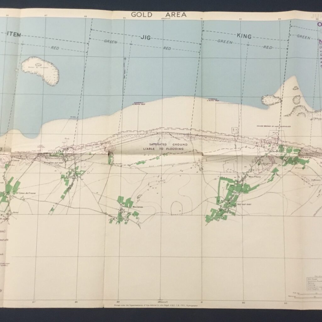
The maps, which cost just £10 as part of a job lot from a local auction, provide restricted-access detail of the five landing beaches of Utah, Omaha, Gold, Juno and Sword.
They had been in the possession of Royal Naval sub-lieutenant Walter Page (1916-1996) who served on Landing Craft Tank (LCT) 2138 – one of 900 such vehicles which played a vital role in transporting men and supplies across the English Channel.
The maps only came to light when their current owner was rifling through an assorted lot of ephemera bought at an auction for just £10.
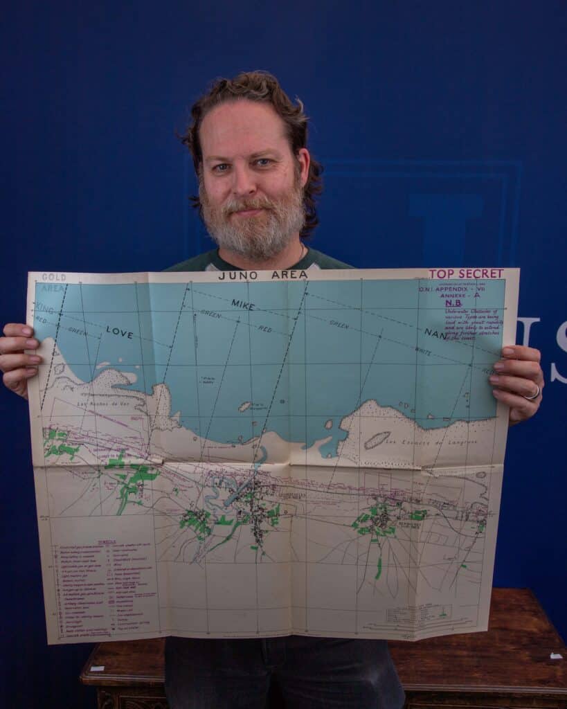
Each map features terrain including hills, woods, villages and roads. Most importantly, they outline in chilling detail the German defences, including enemy strongpoints, barbed wire and even minefields which are marked in purple ink.
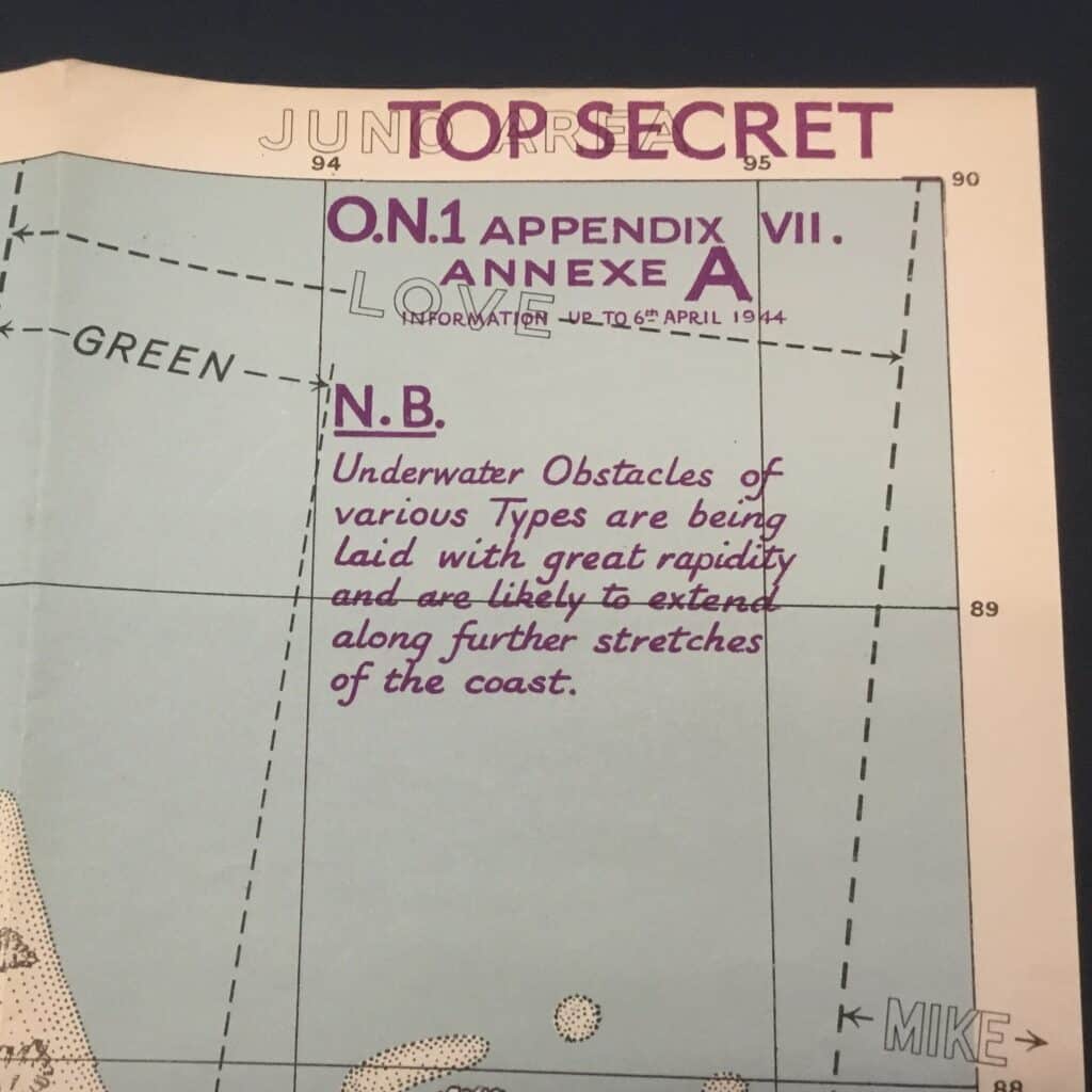
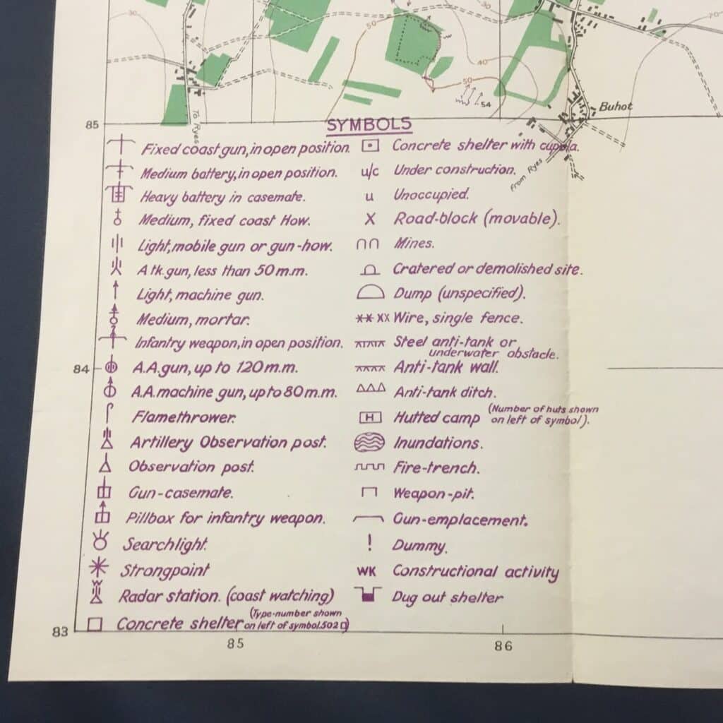
Hansons auctioneers’ military expert, Matt Crowson, said: “Imagine landing on a strange shore under enemy fire and not knowing where you were going or what hazards awaited. These maps, which look so old fashioned today, would have been essential for the D-Day troops. It is amazing to think, had it not been for the eagle-eyed vendor they would likely never have seen the light of day.”
More than 150,000 Allied troops were involved in the successful effort to push the Nazi defenders back from the Normandy beaches, as they sought to decisively turn the tide of WWII.
While the Americans focused on the western beaches of Utah and Omaha, the British and Canadians landed on the eastern shores of Gold, Juno and Sword.
Creating up-to-date maps of the shores was vital for Allied success. Throughout the conflict photo-reconnaissance aircraft had helped create an accurate record of the French coast. And, as it wasn’t known exactly where D-Day would take place, maps had to be developed for a wide area of France.
The German fortifications were formidable. About 2,500 anti-tank obstacles (known as Czech hedgehogs) acted as a terrifying line of shoreline defence, while hundreds of submerged mines proved fatal to troops wading ashore.
Minefields behind the beaches coupled with barbed wire and anti-tank ditches made advancement even more difficult.
The maps are divided into different sectors, in the case of Gold Beach, the area is further made up of Item, Jig and King (using the phonetic alphabet of the 1940s). Each sector was then sub-divided into “red” and “green”.
The detailed D-Day maps were 1:12,500 scale, meaning that one kilometre on the ground is represented by eight centimetres on this map.
Auction Details
Auction: Derby August Medals, Militaria & Firearms Auction
Auction date: 13th August 2025 | 9:30am
Location: Hansons Derbyshire Saleroom
Auction contact: [email protected]
Catalogue/bidding: www.hansonslive.co.uk | www.the-saleroom.com